Category: Information

  • Bank Colony, Konanakunte Bangalore: Location, Connectivity, Nearby Areas

    Bank Colony, Konanakunte Bangalore: Location, Connectivity, Nearby Areas

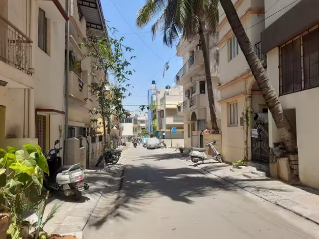
    South Bangalore has a habit of layering neighbourhood over neighbourhood until the boundaries blur, and Bank Colony sits right in the thick of that pattern. Nestled within Konanakunte, close to the Kanakapura Road stretch, it’s the kind of locality that rarely makes headlines but consistently shows up on relocation shortlists — mostly because it does the basics well without charging premium prices for them.
    Bank Colony, Konanakunte Bangalore

    Quick Overview of Bank Colony, Konanakunte Bangalore

    Detail

    Information

    Locality

    Bank Colony

    Area

    Konanakunte, South Bangalore

    Pin Code

    560062 (also listed as 560050 in parts of the locality)

    Nearby Localities

    JP Nagar, Yelachenahalli, Anjanapura, Doddakallasandra

    Nearest Metro Stations

    Konanakunte Cross, Yelachenahalli, JP Nagar

    Nearest Railway Station

    Nayandahalli / KSR Bengaluru City (approx. 11 km)

    Key Roads

    Kanakapura Road, Bannerghatta Road, Outer Ring Road

    Sub-Localities

    Old Bank Colony, New Bank Colony, Mysore Bank Colony

    More Than One “Bank Colony” — What You Need to Know First

    Here’s the detail that trips up most first-time searchers: Bank Colony in South Bangalore isn’t a single, neatly bordered neighbourhood. It exists as a cluster of related pockets — Old Bank Colony, New Bank Colony, and Mysore Bank Colony — all within a short distance of each other in and around Konanakunte. Property listings and delivery apps often use these names interchangeably, so if you’re househunting here, it’s worth confirming exactly which “Bank Colony” a listing refers to before assuming they’re identical. The naming itself traces back to the area historically housing bank employee layouts, which is common across several Bangalore neighbourhoods that share this “Bank Colony” tag.

    Getting Around: Metro, Road, and Rail

    This is genuinely one of Bank Colony’s stronger selling points, and the improvement has been steady rather than sudden.

    • Metro access: Konanakunte Cross, Yelachenahalli, and Doddakallasandra metro stations all sit within roughly 1 to 2.5 km of the locality, giving residents multiple entry points onto the network rather than relying on just one station.
    • Road connectivity: Kanakapura Road and Bannerghatta Road both run close by, linking Bank Colony efficiently to the Outer Ring Road and onward to South Bangalore’s broader commercial belt.
    • Bus network: BMTC services are dense here, with dedicated stops including Bank Colony’s own bus station and several others in the Konanakunte-Anjanadri stretch.
    • Rail access: The nearest railway stations are Nayandahalli and Jnana Bharathi Halt, while KSR Bengaluru City railway station is the major terminus, sitting around 11 km away.
    • Airport distance: Kempegowda International Airport is roughly 40 km from the locality — a genuine consideration for frequent flyers, since this is very much a southern, airport-distant address.

    Residents do flag that road surfaces within the colony’s internal lanes remain uneven in places, and traffic tightens noticeably during morning and evening peak hours, particularly since the opening of nearby shopping destinations added more vehicle footfall to the area.

    What Surrounds Bank Colony

    Living here means being genuinely close to some of South Bangalore’s more established neighbourhoods:

    • JP Nagar — a short drive away, bringing malls, restaurants, and denser commercial infrastructure
    • Yelachenahalli — home to one of the nearest metro stations, functioning as a practical transit anchor for residents
    • Anjanapura — a quieter, developing residential pocket nearby
    • Doddakallasandra — adjoining Bank Colony directly, sharing much of its residential character
    • Munireddy Layout and Soudamini Layout — smaller neighbouring layouts frequently mentioned alongside Bank Colony in local listings

    Everyday Convenience: What’s Actually Close By

    Despite its relatively modest profile, Bank Colony covers most daily essentials within a short radius:

    • Schools including Greenvalley High School and Suryodaya International Public School operate nearby, though some residents note the area could use more options directly within the colony
    • Hospitals such as Konanakunte Government Hospital and Rajnandani Hospital serve the immediate area
    • Shopping needs are met by Sarakki Market, South India Shopping Mall, and the more recently opened Forum Mall, which has added convenience but also visibly increased local traffic
    • Parks, supermarkets, and cinema halls are typically within a 2 km radius, according to residents who describe the locality as fairly self-sufficient for day-to-day living
    • Proximity to IT corridors like HSR Layout, Electronic City, and BTM Layout makes it a practical, budget-friendly base for tech professionals who don’t want to pay premium rents closer to the office parks themselves

    FAQs

    Q: Is Bank Colony, Old Bank Colony, and New Bank Colony the same locality, or should I treat them differently while searching for property?

    Ans: They’re closely related sub-pockets within the same broader Konanakunte area rather than identical addresses. It’s worth confirming which specific section a property listing refers to, since amenities, pricing, and exact distances to landmarks can vary slightly between them.

    Q: How practical is Bank Colony for someone commuting to Electronic City or HSR Layout for work?

    Ans: Reasonably practical. The locality’s proximity to Bannerghatta Road and the Outer Ring Road makes commuting to these IT hubs manageable, and many residents choose Bank Colony specifically because it’s more affordable than living closer to the office parks themselves.

    Q: Does Bank Colony have good banking access, given its name?

    Ans: Ironically, not always. Some residents report having to travel 2–3 km to reach a major bank branch for withdrawals or in-person banking, despite the locality’s name — worth planning around if that’s a regular need for you.

    Q: Is the area safe and suitable for families, or is it better suited to young professionals?

    Ans: Reviews are largely positive, describing it as a posh, well-developed pocket with good infrastructure and regular police patrolling. That said, a few residents have flagged safety concerns and rowdiness in specific pockets, so it’s worth visiting the exact stretch you’re considering before finalising a decision.
  • Aarey Colony, Goregaon East, Mumbai: Location, Connectivity, Nearby Areas

    Aarey Colony, Goregaon East, Mumbai: Location, Connectivity, Nearby Areas

    Mumbai isn’t a city known for green space. So when a 3,000-plus acre stretch of forest, dairy farms, and tribal hamlets exists within the Mumbai Suburban district, it tends to stand out — and stir debate. Aarey Colony, in Goregaon East, is exactly that: part residential locality, part protected ecological zone, and increasingly, part of the city’s expanding metro network. If you’re trying to understand this address — whether as a homebuyer, a nature-seeker, or someone just curious why it keeps appearing in the news — here’s the full picture.

    Aarey Colony Mumbai

    Quick Overview of Aarey Colony Mumbai

    Detail

    Information

    Locality

    Aarey Colony (Aarey Milk Colony)

    City

    Mumbai, Maharashtra

    Suburb

    Goregaon East, Mumbai Suburban District

    Pin Code

    400065

    Area

    Approx. 16 sq. km

    Established

    1949, as a government dairy project

    Nearby Areas

    Goregaon, Powai, Jogeshwari, Malad

    Metro Access

    Aarey (Line 7), Aarey JVLR (Aqua Line 3)

    Nearest Rail Stations

    Goregaon and Jogeshwari, both around 5–7 km away

    Not Your Typical Mumbai Locality

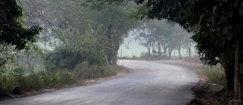
    Aarey Colony sits within the Sanjay Gandhi National Park ecosystem, and that context shapes everything about it. Roughly a quarter of the area is classified as mixed moist deciduous forest, and the colony itself spans twelve smaller villages and hamlets — including the land now occupied by Film City. It was founded in 1949 to secure Mumbai’s milk supply, and while dairy farming still continues here, the area has become far more than that over the decades.

    What makes it unusual for a Mumbai address:

    • Genuine forest cover, not landscaped parks — home to leopards, deer, and dozens of butterfly species
    • Warli tribal hamlets that predate much of the surrounding city’s development
    • A visible presence of film and TV production, thanks to Film City’s location within the colony
    • Ongoing public attention around conservation, following the construction of a metro car shed here that drew significant tree-felling debate in recent years

    For residents, this translates into something genuinely rare in Mumbai: cleaner air, visible greenery, and a slower pace, even while the city closes in from every side.

    Reaching Aarey Colony

    Connectivity here has improved sharply in the last few years, mostly thanks to metro expansion:

    • Metro access: The Aarey metro station on Line 7 opened in April 2022, while Aarey JVLR on the Aqua Line 3 followed in October 2024 — giving the colony two separate metro links within a short span.
    • Local trains: Goregaon and Jogeshwari stations on the Western Line are the nearest, both roughly 5 to 7 km from most points within the colony, so a short auto or cab ride is usually needed to close the gap.
    • Road access: The colony runs along the Western Express Highway, connecting it efficiently to both the western and eastern suburbs.
    • Within the colony: Given its size, getting around Aarey itself often means autos, cabs, or ride-hailing apps like Ola and Uber rather than walking — distances between points inside the colony can be deceptively large.

    Neighbourhoods and Localities Nearby

    Aarey Colony borders some of Mumbai’s more prominent suburbs, and proximity to them plays a big role in property decisions here:

    • Goregaon — the nearest major suburb, offering malls, offices, and established residential complexes
    • Powai — a premium address known for Powai Lake and its IT and business parks
    • Jogeshwari — a busy, well-connected locality with strong rail and metro access
    • Malad — a large residential and commercial suburb with major shopping destinations

    Smaller pockets closer to Aarey itself — such as Adarsh Nagar, Royal Palms, Poonam Nagar, and the BMC Workers Colony — are also frequently referenced by residents and property listings in the area.

    Daily Life Around the Colony

    Despite its semi-rural character, Aarey Colony isn’t cut off from urban conveniences:

    • Schools in the vicinity include Harnai and Gurukul Vidyalaya, Shri Radha Krishna Vidya Mandir, and Oberoi International School
    • Healthcare needs are covered by facilities such as Aarey Hospital and several smaller clinics and dispensaries
    • Shopping and everyday retail are available through nearby options like The Hub Mall and Gagan Shopping Arcade in Goregaon
    • Popular local spots such as Chhota Kashmir, with its lake and picnic areas, add a recreational dimension few other Mumbai localities offer

    FAQs

    Q: Is Aarey Colony a good place to actually live, or is it mainly known for its forests?

    Ans: Both, depending on which pocket you’re looking at. Areas closer to Goregaon East and the metro corridor function as regular residential neighbourhoods with schools and hospitals nearby, while deeper sections remain genuinely forested and rural in character.

    Q: How has the metro changed connectivity to Aarey Colony?

    Ans: Significantly. Before 2022, residents relied almost entirely on autos from Goregaon or Jogeshwari stations. With both the Aarey and Aarey JVLR metro stations now operational, commuting to central and western Mumbai has become considerably faster.

    Q: Why does Aarey Colony keep coming up in the news?

    Ans: Largely due to the metro car shed built within the colony, which triggered public debate over tree felling and conservation. It’s worth knowing this context if you’re researching the area, since environmental protection remains an active and evolving issue here.

    Q: Is Aarey Colony far from Mumbai’s main railway lines?

    Ans: Not extremely, but it isn’t right on top of a station either. Goregaon and Jogeshwari stations are both 5 to 7 km away, so most residents combine local trains with a short auto or metro connection rather than walking directly to a station.